Head lice are every parent’s dreaded visitor—tiny, relentless bugs that turn a peaceful household into an itchy battlefield. These pests often show up when school is in session, spreading fast through close contact or shared personal items. If you’ve dealt with lice before, you know it’s a time-consuming process filled with combing, treatments, and lots of patience.
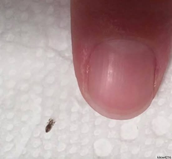
Lice are small, wingless insects that live on the scalp and feed on blood. They lay sticky eggs (nits) near the scalp, making them hard to remove. While lice don’t spread disease, their presence causes intense itching and discomfort. They can also survive off the scalp for up to 48 hours, making thorough cleaning essential.
To get rid of lice, start with a medicated shampoo or lotion specifically made for lice treatment. Follow the product instructions carefully, ensuring proper application and timing. This step kills live lice but often leaves behind nits, which must be removed manually.
Use a fine-toothed nit comb on wet hair to comb out nits and dead lice. Work in small sections and wipe the comb after each pass. This step is crucial to prevent reinfestation. Most treatments need to be repeated after 7–10 days to catch any newly hatched lice before they lay more eggs.
Cleaning your home is equally important. Wash clothing, bedding, and accessories worn in the past two days in hot water. Items that can’t be washed should be sealed in plastic bags for two weeks. Vacuum areas where the infected person sat or lay down to remove stray lice.
To prevent future outbreaks, teach kids not to share personal items like combs or hats. Regularly check their scalp, especially during school months, and keep long hair tied back. If lice persist or cause infection, consult a doctor for prescription treatment. With consistency, lice can be conquered.